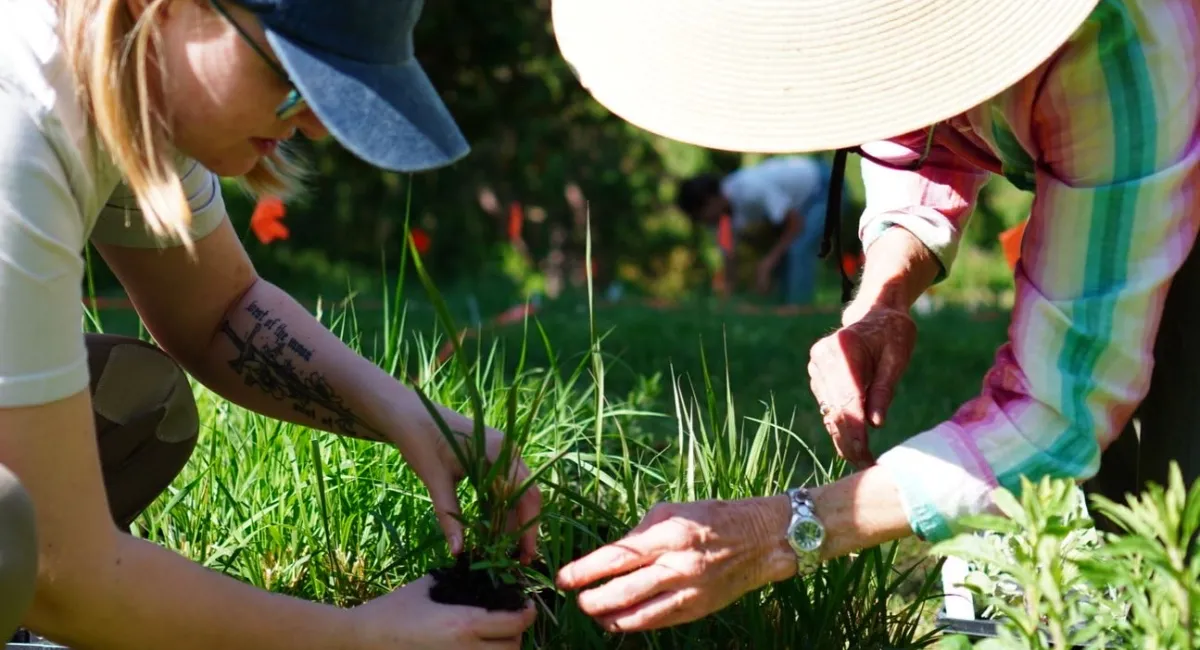
Learn Seedling Identification
When plants grow in suitable site conditions, they will start to disperse their seeds. When these seeds start to germinate, we need to learn how to identify their seedlings so we don’t weed them out by mistake! Here’s a spreadsheet of seed and seedling ID resources that a Chicago Botanic Garden intern assembled. A few resources stood out:
- Photos of Northeastern native plants as seedlings, emerging and mature plants created by GrowIt BuildIt duo, Joe and Tara Foster.
- Illinois’ Morton Arboretum provides photos of nearly 60 of our common sunny prairie plants.
- Eastern Illinois University’s Prairie Restoration site has photos of not only the seedlings, but the seeds and fruits.
- Iowa Department of Transportation Prairie Seedling Guide has about 80 species including grasses.
Prairie Plants in Vermont
Pre-European contact, this region of the continent was primarily covered in forests, except for small grassland patches along wetlands, river and lake shores. Following contact, most of the region was cleared for agriculture and development, and seeded with Eurasian lawn, pasture and hay grasses. Many of these pastures and fields have naturally reforested over the past century as their agricultural use has declined. However, since current landowners may seek to retain some of these sunny open spaces, it is worth noting that these areas can be planted with appropriate native species to create new “Champlain Valley prairies”.
Here, you’ll find a description of our ecoregion, some expected climate migration patterns, and useful explanations and relevant plant lists from nearby regions.
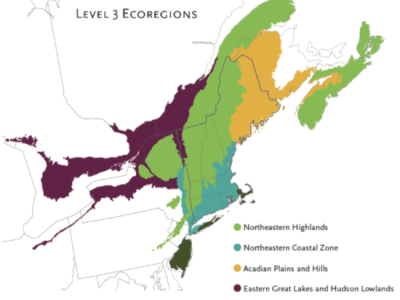
Our ecoregion: The Champlain Valley is in the Eastern Great Lakes/Hudson Lowlands ecoregion, shown in maroon on this map from the Native Plant Trust.
Notice how the Champlain Valley is part of a larger region along the St. Lawrence River watershed that extends west into Ohio along Lake Erie, thus connecting us to the northern prairie plains and plants. Its location at the eastern and northern edge of warmer climate plant communities makes the Champlain Valley home to unusual plant diversity.
Here is the full EPA Ecoregion Level III map, and here are descriptions of the Level IV Ecoregions of New England.
From Native Plant Trust Garden Plant Finder
Climate migration in motion
This Migrations in Motion map, created by The Nature Conservancy, models likely bird, mammal and amphibian migration as climate change alters habitat. Our ecoregion’s connection with the Great Lake and coastal zones creates corridors for plants and animals as they move eastwards and northwards; therefore we should look west and south for current models of our potential future natural communities.
Useful explanations:
- North American Prairie Species of New England - Ecological Landscape Alliance - Prairie Nursery founder Neil Diboll () explains prairie species of the Northeast.
- Wild Ridge Nursery’s Jared Rosenbaum gives reasoned and inspiring rationale for creating diverse grassland natural communities in lawn, field, roof top, etc. sites by planting species that could have moved here 8000 years ago via the Prairie Peninsula during a warming period.
- An article from the British Ecological Society in the Journal of Applied Ecology explains The differences between rewilding and restoring an ecologically degraded landscape - (spoiler alert, it has to do with whether plant selections are made from past or suspected future conditions).
- An Atlantic Monthly article, "Trees Are Overrated" explains how grassland communities are being overlooked and undervalued, especially the increasingly rare fragments of "old growth grasslands" due to our cultural and colonial bias for trees vs. "scrubby degraded grassland". Grasslands host an equivalent level of biodiversity as old growth forests, and are similar carbon sinks.
Prairie Plant List Models:
For those who aspire to create prairie plant diversity that matches soil conditions on our sunny sites, we’ve assembled plant lists for prairie grasslands in our ecoregional-neighbor states: Ohio, New Jersey, New York, Pennsylvania, Michigan, Wisconsin and Minnesota. The latter states are along the southern edge of the recent glaciation that forced nearly the same suite of plant species (and their insect partners) southwards then back northwards with the advance and retreat of the Wisconsin Glaciation.
- Within our Ecoregions:
- Plant Communities of New Jersey by B. R. Collins and K. H. Anderson is in book form.
- New York natural communities: some of the relevant grasslands include
- Floodplain grassland
- Hempstead Plains grassland (most similar/extension of midwestern sand prairie and includes our rare maritime species and New York natural prairie communities “showy garden” species)
- Pitch Pine Heath Barrens
- Successional northern sandplain grassland
- Ohio’s black oak savannah/midwest sand barren and lake plain prairie are the most relevant and along the western edge of our Eastern Great Lakes/Hudson Lowlands ecoregion.
- Pennsylvania plant Terrestrial (upland) communities. Scroll through the Herbaceous Openings for grassland lists.
- Within our Wisconsin Glaciation edge:
- Michigan prairie communities:
- Dry Prairie Group of communities
- MI dry sand prairie for sandy soils
- Wet Prairie Group of communities
- MI lakeplain wet prairie and MI lakeplain wet-mesic prairie for clay soils
- Dry Prairie Group of communities
- Minnesota prairie communities:
- Wisconsin natural communities; some grassland examples. Note “detailed community description” link on each page.
- Dry prairie
- Dry mesic prairie
- Mesic prairie
- Sand prairie
- Wet prairie where there are heavier soils (higher percentage of silts and clays)
- For partial shade, savannah type sites like our suburban lots, check these: Oak barrens, Oak Openings, and Oak Woodland.
- Michigan prairie communities:
- Additional useful plant list resources:
- Midwestern Plant Communities - a text that includes a 705 page appendix of plant community descriptions. Prairie community descriptions start at page 661.
- Loess Hills Plants Database and its key is an impressively comprehensive plant list with germination codes, light and soil moisture needs, height, color, bloom time, faunal users, etc.
- Tallgrass Prairie Center’s ‘Designing Seed Mixes - helpful guidelines on designing species diversity.
- The Prairie Ecologist’s Blog is written by Chris Helzer, The Nature Conservancy’s Director of Science in Nebraska, who evaluates and captures lessons from the Conservancy’s land management and restoration work and shares those lessons with other land managers.